Sailing into the "Uncharted" Waters of the Upper Patuxent
The bridge carrying Maryland 216 doesn’t open very often. I found that out the hard way upon making inquiries in Benedict after rowing ashore to a landing that wasn’t public. There’s a phone number listed on the chart, but nobody answered when I called. There was nothing about calling up on Channel 13, the normal means of talking to bridge tenders.
Eventually a figure appeared, and I could detect an annoyance in his voice that the strange sight of a sailboat had requested his services so early on a Sunday morning. I began to feel uneasy but increasingly quizzical about the motivation behind my desire to go beyond the bridge, and the fact that I couldn’t answer him with a definitive return time seemed to put a dent in his weekend plans. Standing a good way off against a foul current, he wouldn’t open the bridge until I got closer. Fifty yards seemed good enough for me, but it didn’t open until I was practically a stone’s throw away from the puzzled motorists stopped on the bridge.
Clearly, this was unusual, which made it all that much more fun. The 14-year old explorer in me was reawakened. Or maybe the 11-year old who fashioned Brown Bess muskets out of cedar to hunt with the Iroquois in suburban Toronto. Now I was following in the wake of the British Fleet up the Patuxent past a bridge that apparently had not opened for a wind-driven vessel in anybody’s memory. It all felt pretty neat but not without trepidation after Red 32, the last government mark, was passed off Trueman Point. I still had gimpy steering, and there are no services of any kind above the bridge.
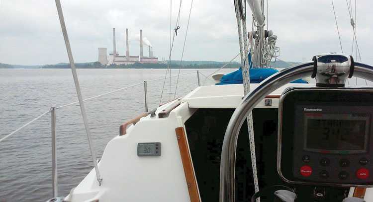
The first set of overhead powerlines above God’s Grace Point was sufficiently lofty; the second not so much. At 53 feet, I’ve had closer encounters with bridges, but my 37-foot mast hoped that the chart was correct as I braced for certain friable death for a moment or two. The river narrows here, but it still runs deep—20 feet or better.
As the shores closed in, it became more beautifully rural and serene mile after bucolic mile. There was traffic, it being a holiday weekend, but not very much: smallish powerboats, waterskiing, tubing, and fishing, reminiscent of what you might see on northern lakes. A Hobie Cat graced a boatlift on the Calvert side, the only other mast I saw on the whole excursion. Drawing strange looks of wonderment from other boats, I began to feel a little silly. But the river had me in her clutches, drawing me ever further upstream, not really knowing what to expect other than what I could see on the chart. A grand adventure was unfolding; I savored every moment of it.
Ever more rural and unspoiled, the Patuxent taught me lessons of river navigation at every turn. Cut too close inside a turn, and the water is thin; while the outside sweep is deep but the current swifter. Landings appeared infrequently, with names like Magruder, Milltown, White, and Deep. Most of them seemed to attract family fishing, and a couple of the gatherings were quite large.
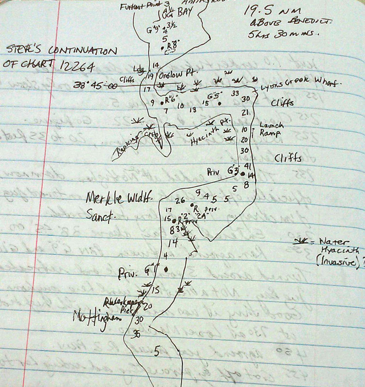
The river shallowed and the channel ended abruptly below Nottingham, and just above it, Chart 12264 stopped. The British fleet had landed here, too, and perhaps later chartmakers conspired to quell future invasions. Nottingham, I later learned, is home base of indomitable Patuxent Riverkeeper Fred Tutman, who would (a year later) delight me with the tale of a photo he had taken of someone in a sailboat way up here last year, which turned out to be me.
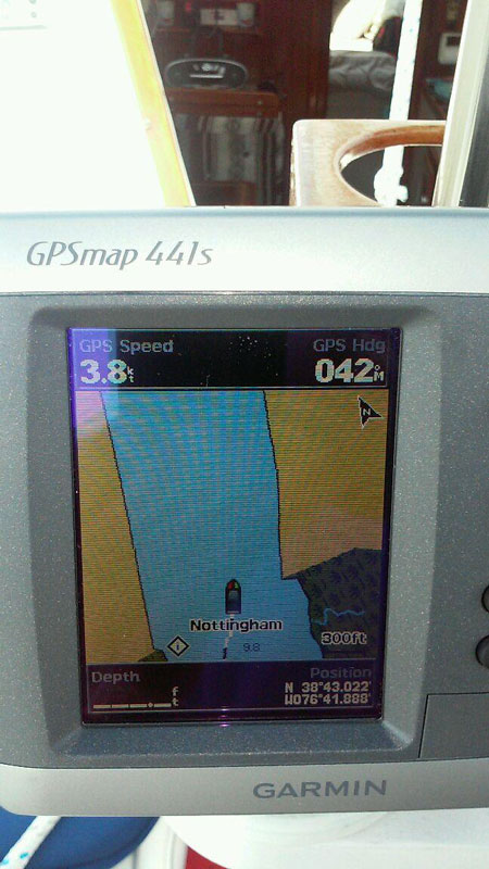
On my own, I opened the log to sketch out a crude “chart” as I proceeded slowly, relying on the depth sounder and luck, naming points and creeks along the way as John Smith might have done. I saw a few kayaks and canoes, and just one small fishing boat as I inched along. Private marks appeared, and for the most part were helpful. Past Green 3 I sounded 41 feet, and started to feel confident again. I noted “North 38. 45.00” just before the wide expanse of Jug Bay opened up. Hoping for a place to anchor and spend the night, I instead ran aground 19.5 nautical miles above Benedict, and 44 miles beyond Solomons. Oh for a swing keel and a kick up rudder.
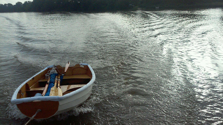
Pirouetting around and churning up sticky mud, I retraced my route only to hit bottom again on a falling tide. Back on the charts again below Nottingham, I anchored in nine feet of water for the night in one of the most peaceful spots imaginable within marching distance of Washington. No cell service, no shore lights, just one other boat passing by to break the scene. I took the dinghy out among a marshy creek on the Prince Georges side and watched the sun set amid the increasing chatter of crickets and tree frogs. I slumbered with a feeling of warm accomplishment in discovering this new happy place of absolute solitude, and dreamed the dreams of a geeky teenager exploring the world in an old man’s body.
By Steve Allan


