For All Boaters: How Do Thunderstorms Form?
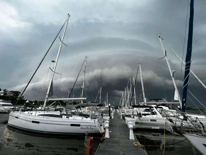
A flash of lightning, a distant rumble, and the realization that your pleasant day on the Chesapeake Bay is about to change. Thunderstorms, with their risk of blinding rain, frequent lightning, and most dangerous of all, strong wind gusts, can change your plans in an instant. Whether you’re a sailor, angler, powerboater, or paddler, anyone who enjoys the water will benefit knowing a bit about thunderstorm formation.
Thunderstorms form when a layer of relatively warmer and moister air near the ground is nudged upward. Frontal boundaries, such as cold fronts, warm fronts, and stationary fronts, can provide a strong source of lift and are often associated with long-lived and destructive thunderstorms. In an interesting twist, wind from nearby thunderstorms may may also promote new storms by forcing air upward. More subtle and transitory forms of lift, such as sea breeze fronts or pockets of localized solar heating, can also lead to thunderstorm development.
Even with a nudge upward, warm moist air can’t blossom into a thunderstorm without support from the upper atmosphere. Like the dynamics governing the steady rise of a hot air balloon, the air within a fledging thunderstorm updraft must remain warmer than the surrounding environment to continue its upward journey. Therefore, thunderstorms form in environments characterized by warmer moister air near the ground and colder drier air aloft.
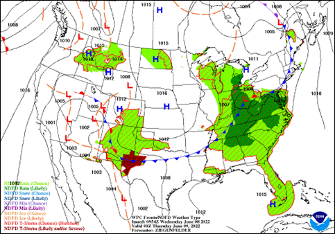
Learning to interpret a surface weather map can help you identify regions where thunderstorm development is possible. Severe Weather Watches and Warnings from the National Weather Service (NWS) are a great resource for staying safe on the water. The (NWS) classifies thunderstorms as “non-severe” or “severe.”
A thunderstorm is considered severe when it produces one of the following: a wind gust greater than 50 knots (57.5 mph), a hailstone greater than 1 inch in diameter, or at least one tornado or waterspout. And it’s possible for all three criteria to occur in the same storm.
Reading a surface weather map, keeping an eye on the sky, monitoring your weather radar app, and checking for NWS Watches and Warnings can help you avoid a hair-raising and windswept encounter with a thunderstorm.
By Mark Thornton of LakeErieWX
ALL boaters are welcome to sign up for our Thunderstorm Seminar in March to learn more.


