Cruising the "Uncharted" Waters of the Patuxent River
It isn’t often today that real adventure is encountered by chance. Too often it’s programmed and predictable, with little left to capriciousness or throwing caution to the wind. In the summer of 2015 I found a whole lot of the latter on the Patuxent River far from the madding crowds of the cruising hordes, perhaps just by letting a child’s adventure in a man’s body run wild. Arriving in Solomons after a windward slog down the Bay from the Little Choptank, some serious contemplation was in order. The whole cruise was on the skids. First Norfolk, then Smith Island were dropped because of a gimpy steering cable that had bunged up somehow, not to be trusted again. The autopilot failed to respond as a result, rendering my electronic crew out of commission.
I tried to console myself that giving in to such minor trials isn’t the sort of mettle that cruisers are supposed to possess. I still had an emergency tiller if the gear failed completely. I’d steer the rest of the trip by hand if need be. I needed an adventure, no matter how timorous. So instead of striking out for Smith Island I decided to explore the Patuxent River as far as I could possibly go. Not the smartest decision I’ve ever made, mostly because sailing to Smith would have been a lot less complicated, and as it turned out, much less capricious. The route to Smith was known and charted. Going up the Patuxent, not so much, but not exactly Rutherfordian either. But as I started asking around in Solomons, nobody seemed to know how far up it was navigable. It didn’t even sound as if anyone had ever gone up there in a sailboat, aside from the British Fleet in 1814. If it was good enough for them, the 14-year old kid in me reckoned, it’ll be good enough for me, long enamored with a adolescent desire to explore just for the fun of it.
The British Fleet landed at Benedict as well as Nottingham and beyond, where curiously, Chart 12264 stops, probably to thwart future invasions. This was becoming more intriguing and mysterious. Studying the chart showed the possibilities with deep enough water and sufficiently clear overhead draft, but not much was known as my quest for local knowledge bore out. If nothing else, I thought Benedict would be far enough to claim victory. The fact that the Patuxent is the deepest, longest river entirely within Maryland enticed me even more. Out of Solomons there are a half dozen creeks to choose from, but St. Leonard is best known. Not so much is written in the cruising guides about the hidden treasure along its western shore. Mary Marvin Breckinridge Patterson donated this 550 acre piece of land to the State to be used as a natural resource and education facility in perpetuity. Today, Jefferson Patterson Park and Museum, run by an arm of the Maryland Department of Planning, is home to the Maryland Archaeological Laboratory, interpretive excavation sites for pre-European contact and early colonial history, and detailed down-to-the-linen War of 1812 battle reenactments every September, commemorating the real ones that took place here. This was the site of Maryland’s largest naval battle, in June and again in August 1814, where American engagement to repel the British from advancing toward Washington, DC, was bravely waged.
The river is wide and deep, crazy deep under the Johnson Bridge carrying MD 2 and 4, where the chart says 100 feet and more. Red 8 guarding Point Patience is almost on the sandspit, but you can reach out and almost touch it while your sounder reads 80 feet. The rest of the river is uncomplicated, but there are some tricky entrances to Cuckold, Island, and Battle creeks as you work your way upstream. Some sailors abhor the certainty of good anchorages while river cruising, but the lure of the river had me hooked. The Patuxent, still deep, seemed to get prettier and more alluring the farther I traveled, a song to the siren leading to some untimely fate.
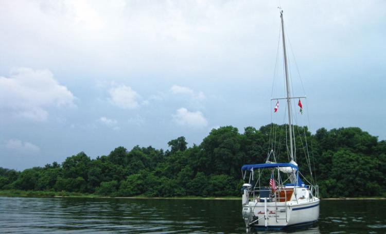
Then, after ducking under Sheridan Point for a passing thunderstorm, appeared the ominous hourglass cooling tower of the Chalk Point power station in Prince George’s County just above Benedict to port. With spotty cell service it didn’t occur to me that it wasn’t a nuclear, but a coal plant, but still it was enough of a spooky presence to cast a pall over the otherwise bucolic scene, half expecting Jane Fonda and Jack Lemmon to appear as they did in The China Syndrome. At last Benedict was reached, but the welcome mat for cruising sailors wasn’t evident. The way in toward the only enticing restaurant didn’t look as if it carried enough water, so I circled around outside the piles far enough to be out of the way for early morning fishers. Or so I thought. It was July 4. The Canadian flag I still had flying from the starboard spreader from four nights earlier was hopelessly stuck in the halyard block. Given the history of 201 years prior, I don’t think it enamored me to the locals. But it was probably more the boat than the flag, as tomorrow morning’s bridge opening adventure was to prove.


