The Lovely Chesapeake Bay in 1608 and Today - Part One
Many sailors are familiar with NOAA’s Chesapeake Bay Interpretive Buoy System, consisting of bright yellow buoys that provide weather and water-quality data for boaters on the Susquehanna, Patapsco, Annapolis, Goose’s Reef, Potomac, Stingray Point, York Spit, Jamestown, and First Landing. CBIBS also provides history along the Captain John Smith Chesapeake National Historic Trail (accessible by buoybay.noaa.gov, (877) BUOY-BAY, or app). We thought it would be fun to compare Captain John’s Smith’s Chesapeake with the one we sail on today. Historical tidbits are courtesy of buoybay.noaa.gov/locations.
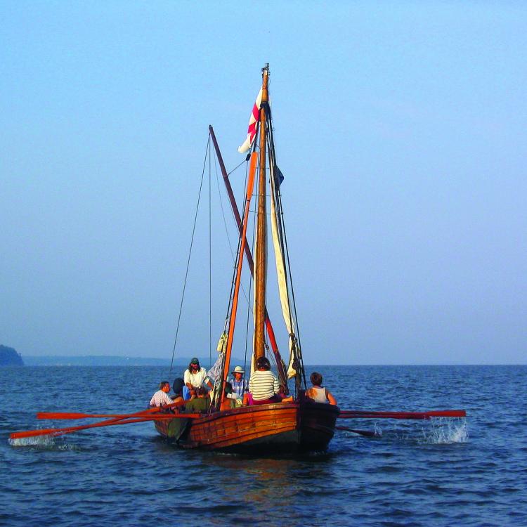
1608: The NOAA smart buoy sits in 20 feet of water surrounded by shallower lumps that would have been large oyster reefs when Captain John Smith and his crew arrived here, June 12, 1608, during their first exploratory voyage up the Bay that summer. They came to this river after leaving the Eastern Shore and crossing the Bay to the Calvert Cliffs before sailing north.
“We passed many shallow creekes, but the first we found Navigable for a ship, we called Bolus (Patapsco), for that the clay in many places under the clifts by the high water marke, did grow up in red and white knots as gum out of trees,” wrote Smith.
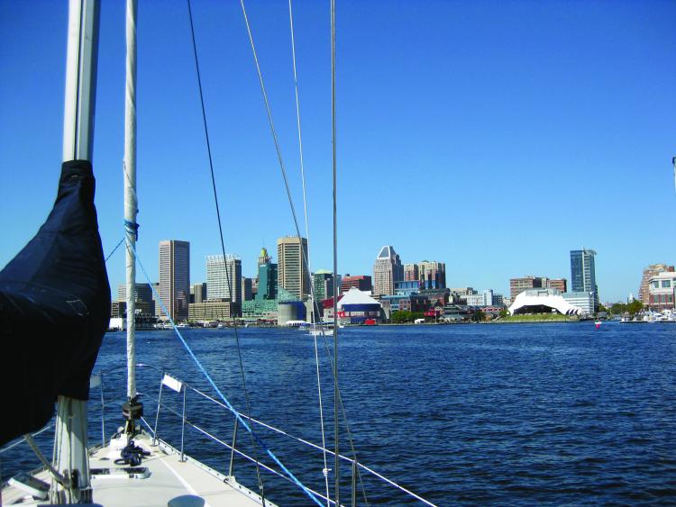
Today: Although newcomers may be daunted by the boat and ship traffic, cruising sailors sail into the Patapsco for an “urban escape” in Baltimore to see ball games, watch air shows, attend festivals, see fireworks off Fort McHenry, and tie up at the many marinas on the city’s waterfront. The Baltimore City Yacht Association hosts a lively Tuesday night racing scene as well as popular annual regattas, such as the Race to Baltimore (starting at the mouth of the Magothy) in July and Harbor Cup in October. Maryland’s flagship Pride of Baltimore II calls the Patapsco home.
1608: Captain John Smith and his crew sailed their Discovery Barge close to the mouth of the Severn River as they explored the Chesapeake’s upper Western Shore, but they did not explore any of the rivers here in detail—the West, Rhode, South, Severn, or Magothy.
Smith’s primary objective was to find the Northwest Passage through the continent to the Pacific Ocean, which his patrons at The Virginia Company of London were convinced lay within the Chesapeake.
He dismissed these rivers with the following comment: “The western shore by which we sailed we found all along well watered, but very mountainous and barren, the valleys very fertile, but extreme thick of small wood so well as trees and much frequented with wolves, bears, deer, and other wild beasts. We passed many shallow creeks but the first inlet we found navigable for a ship we called Bolus...” The detail on his map suggests that he looked briefly into the West and Rhode Rivers, noted the mouth of the South River, came far enough into the Severn to note Spa Creek’s mouth to the southwest and Whitehall Bay to the north, and passed close enough to the Magothy to note its narrow mouth before turning into the Bolus, which is today’s Patapsco.
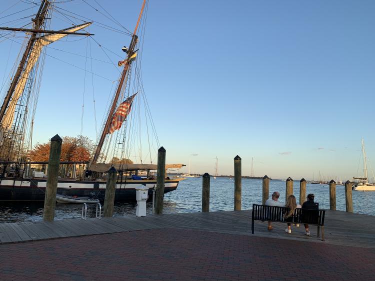
Today: Annapolis has earned its moniker of America’s Sailing Capital for many reasons: its hub of world-class marine services, the United States Sailboat Show, a welcoming and attractive harbor, and active sailboat racing scene all year long. Noteworthy sailing clubs include Annapolis and Eastport Yacht Clubs and Severn Sailing Association. Maryland’s capital boasts plentiful sailing school and charter opportunities. The Annapolis Waterfront and Sailing Center hosts visiting tall ships and classic yachts as well as STEM programs for young people, and Chesapeake Region Accessible Boating offers accessible sailing programs for all. Of course, your favorite sailing magazine has its world headquarters on Back Creek in the Maritime Republic of Eastport.
1608: Captain John Smith and his crew turned their Discovery Barge from the main Bay into the Potomac here June 16, 1608 on their first exploratory voyage up the Bay that summer. They had gotten as far up the Bay as the Patapsco and Gunpowder Rivers, but with food running low and several days of foul winds, the crew persuaded Smith to head south.
“The 16th of June we fell with the river Patowomek (Potomac): feare being gone, and our men recovered, we were all content to take some paines, to know the name of that seven mile broad river: for thirtie myles sayle, we could see no inhabitants,” wrote Smith.
Smith had learned of this river during his captivity with Powhatan the winter before and understood the south (now Virginia) shore to be part of the great chief’s dominion. He knew of several major native towns up this river, wanted to map it, and as always, hoped to find gold, silver, and the mythical Northwest Passage through the continent to the Orient.
Thus, despite the lack of provisions, but trusting that they would find friendly natives, captain and crew turned their Discovery Barge to the west and entered the river, which they would spend the next month exploring. Smith’s journals record several adventures, and his map records extensive visits to native towns and villages on both sides of the river.
Today: Some sailors only ever know the Potomac by its 11-mile-wide mouth, which can churn up like a washing machine; racers know it by entering at night during the Governor’s Cup Regatta taking them from Annapolis up the St. Mary’s River, which is just inside the Potomac on the Maryland side. Those who take the time to venture farther up the Potomac, even as far as DC 120 miles away, are rewarded with deep and wide navigable water. The landscape is surprisingly eclectic with areas of sandy cliffs, pine forests, marsh lands, and mansions spread throughout. Bald eagles and ospreys rule the skies, and wading birds and ducks feed on the shoreline; if you’re a birder, the trip will not disappoint.
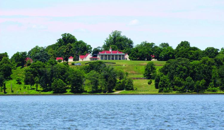
Past the 301 Bridge, Goose Bay and Port Tobacco are worthwhile for their stunning sunsets. Cruising past Quantico, Mallows Bay, Mount Vernon (friends recommend anchoring here), Fort Washington, and Old Town Alexandria, VA, makes for a fascinating trip toward the nation’s capital. Mind your channel markers, as it does get shallow past the 301 Bridge.
Sailors from Alexandria and Washington, DC, race and socialize through a number of clubs, such as the Potomac River Sailing Association, Dangerfield Island Sailing Club, and Capital Yacht Club. DC Sail is an active community sailing center, offering youth programs, high school racing, learn-to-sail classes, regattas, and schooner sailing to connect people in the metropolitan region to the water.
Learn more about the Chesapeake Bay Interpretive Buoy System here.


